MT. TAMALPAIS- “VARIETY ON MT. TAMALPAIS”

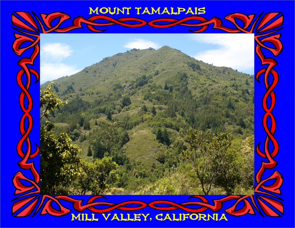
MAJESTIC MT. TAMALPAIS ON A BEAUTIFUL SUNNY DAY. PHOTO BY BEN UPHAM.
MT. TAMALPAIS PHOTOS & ARTWORK
MT. TAMALPAIS-
“VARIETY ON MT. TAMALPAIS”
BY DON AND PHILA WITHERELL
THE OAKLAND TRIBUNE
OAKLAND, CALIFORNIA
JUNE 21, 1969
Rising from ocean cliffs and sandy beaches in the west and from San Francisco Bay in the East, Mt. Tamalpais dominates the Marin County landscape. Two hundred miles of trails crossing the State Park, Municipal Water Co. land, and Muir Woods National Monument offer the hiker an enticing variety of scenery.
The walk we took traverses one of the upper slopes of Tamalpais. From these heights are extravagant views of the Pacific Ocean, San Francisco Bay and the land that surrounds the Bay. In the Summer the coast line is usually obscured by fog which flows through the Golden Gate and spreads over the Bay to pile thickly against the East Bay hills. Except on the most overcast day Mt. Tamalpais stands above the mists, warm and inviting.
Begin this beautiful four mile hike at Pan Toll Ranger Station (1,500 ft.) in Mt. Tamalpais State Park. To get there take the Mill Valley turnoff from Highway 101 and watch for Mt. Tamalpais signs. Turn right on the Panoramic Highway (off State Highway 1) pass Mountain Home Gift Shop and Restaurant and continue up the winding route until you come to Pan Toll Camp and Ranger Station. Leave your car in the parking lot and be prepared to pay a 75 cent fee. Cross the highway and take the Old Stage Road, a narrow asphalt road that veers sharply to the right. The road ascends a hillside that is thickly forested with Douglas Fir, bright with new needles, Madrone, and several varieties of oak. The fresh pale leaves of the tan oak contrast strikingly with its dark green mature foliage.
The road forks just beyond a small concrete block structure. Proceed left on the dirt road marked with a California hiking and riding trail sign. This essentially level road brings you to the south slope of the mountain where sweeping views present themselves — Muir Woods, dense with redwoods, is below you and beyond is the Bay, San Francisco, and depending on the weather, part of the coast line.
Closer at hand are beautiful rock out-croppings and the most spectacular aggregation cf chaparral that we have yet encountered. The chaparral pea, an impenetrable shrub with its stiff branches and thorns, is blooming now with a bright magenta blossom. Toyon and Manzanita have new berries and the chamise is covered with sprays of tiny white blossoms.
The trail crosses several ridges of blue-green serpentine growing out of those formidable rock cascades are Gower cypresses. Although lost among the rock, several large specimens grow along the road in pockets of richer soil. The scale-like leaves are pungently fragrant and attractive small cones ornament the limbs.
On its inward curves the trail crosses Rattlesnake Creeks (No. 1 and No. 2) which are both spring fed and active all year. Azaleas perfume the air and Woodwardia ferns lift their graceful fronds to the light.
Stop at West Point Inn (about 1% miles from your starting point, 1,800 ft. elevation). This rustic structure was built 75 years ago and served as a lunch stop and inn along the route of the old Mill Valley-Tamalpais Railway.
The railroad was abandoned in 1930 and the inn is now owned by a private club which generously offers the use of their porchs and tables to the hiker. No food is available, but coffee, tea and lemonade may be purchased. It is a pleasant place to linger—listening to hiker’s conversations and absorbing the magnificent views over the tops of Monterey pines.
Behind the inn are several trail signs. Take the trail marked Rock Springs Trail to Mountain Theater roughly paralleling the Stage Road at a higher elevation, you thread your way single file through head high chaparral. Above is the summit with its radar domes and below more dramatic vistas. Red Indian paint brush and bush poppy mingle with Ceonothus, Chamise and Manzanita.
The creek beds, crossed often on simple plank bridges are mostly dry now. Along their edges are small Laurel trees growing in clumps like Aspens with their slender trunks tufted with mosses. As the trail bends south the forest grows denser and a turnstile, out of context here, tells you that Mountain theatre is close by. This unique outdoor ampitheatre, with seats of native stone, looks as if ii could be a relic of another era. It is, however, most contemporary and in the summer dramatic and musical programs are presented.
To return to the trail clamber down into the ampitheatre, bear right past the restrooms, and follow the Easy Grade Trail (the only moderately steep part of the walk.) The final descent through firs and oaks returns you to Pan Toll.
The State Park does not have a map or brochure. However for 60 cents you may purchase a large trail map of the Mt. Tamalpais Region at Mountain Home. A National Geological Survey Map of the San Rafael Quadrangle is an interesting reference for trail information and location of landforms.
Remember this walk, too, for the winter days when the Bay Area lowlands are smothered in dense tule fog, but high places such as Mt. Tamalpais stand above in warm winter sunshine.
CLICK THE LINK BELOW TO SEE MT. TAMALPAIS PHOTOS & ARTWORK:
MT. TAMALPAIS PHOTOS & ARTWORK